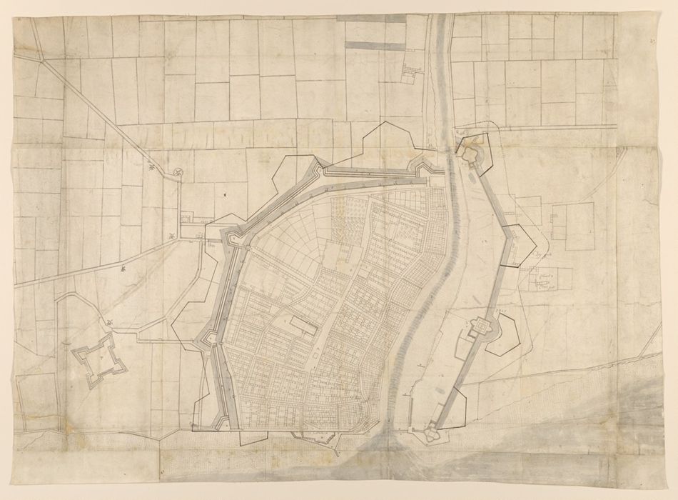
Archer, James, approximately 1632-approximately 1680
Title:
Plan of the town of Hull and its immediate surroundings.
Published / Created:
ca. 1680.
Physical Description:
1 map : pen and ink and watercolor ; 67 x 94 cm
Collection:
Rare Books and Manuscripts
Copyright Status:
Copyright Not Evaluated
Classification:
Maps & Atlases (manuscript)
Notes:
Provenance: From the collection of George Legge, first Baron Dartmouth, 1648-1691 (see Sotheby's sale, March 8-10, 1948). Baron Dartmouth was Master-General of the Ordnance to Charles II and James II. His collection of maps was partly abstracted from Royal map collections, an arrangement described by Pepys in Bodleian Library MS Rawl. A. 171, 17r-20v. See also Skelton and Wallis. The map is numbered "vi.39" in graphite.
Subject Terms:
Fortification -- Great Britain. | Great Britain -- History, Military -- 1603-1714. | Great Britain -- Defenses. | Hull (England) -- Maps. | Hull (England) -- Buildings, structures, etc.
Form/Genre:
Maps -- England -- Hull | Ink drawings. | Watercolors.
Contributors:
Dartmouth, George Legge, Baron, 1648-1691, former owner.