Yale Center for British Art
Creator:
Moll, Herman, -1732
Title:
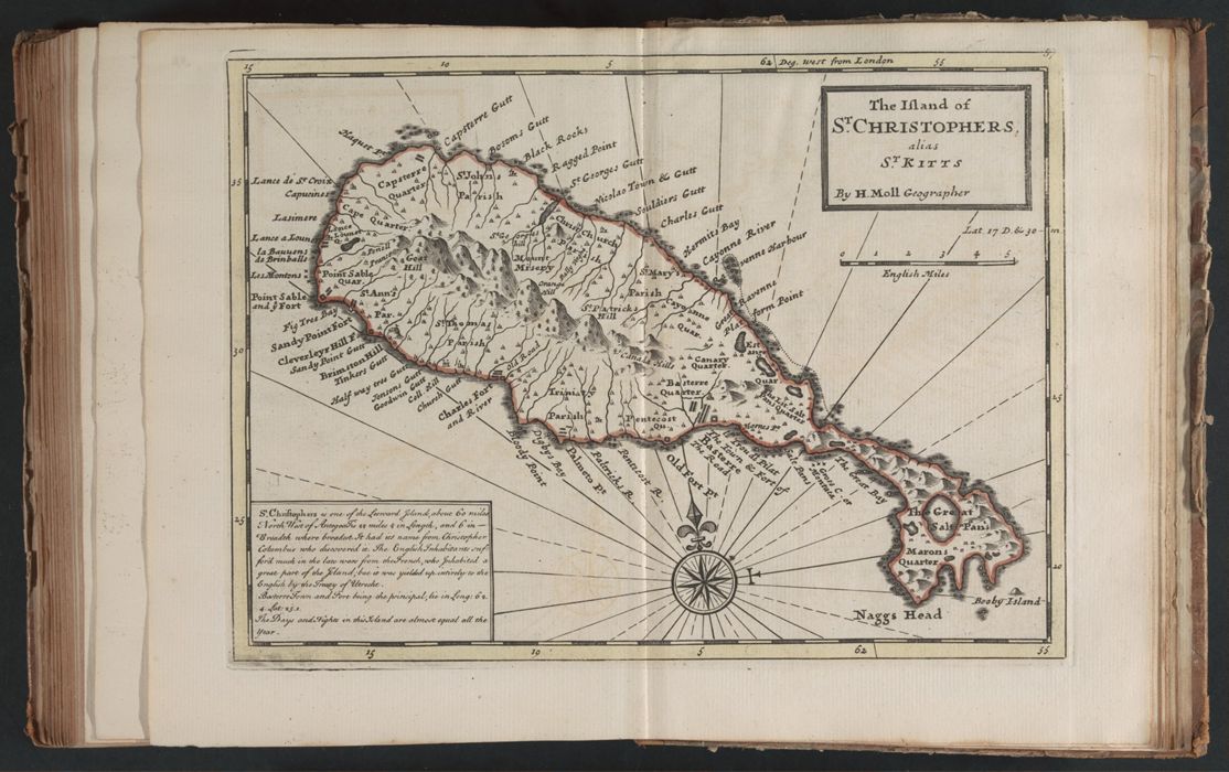
Atlas minor, or, A new and curious set of sixty two maps : in which are shewn all the empires, kingdoms, countries, states, in all the known parts of the earth : with their bounds, divisions, chief cities & towns, the whole composed & laid down agreable to modern history / by Herman Moll ...
Published / Created:
[London] : Printed for John Bowles at the Black Horse in Cornhil, & Carington Bowles in St. Paul's Church Yard, London, [1763?]
Physical Description:
1 atlas ([2], [124] leaves (some folded)) : 62 maps ; 24 cm.
Collection:
Rare Books and Manuscripts
Copyright Status:
Public Domain
Related Content:
View a selection of digital images in the Yale Center for British Art's online catalogue https://collections.britishart.yale.edu/vufind/Record/1673615
Classification:
Books
Scale:
Scales differ.
Notes:
Maps are hand-colored.
Exhibition History:
Figures of Empire: Slavery and Portraiture in Eighteenth-Century Atlantic Britain (Yale Center for British Art, 2014-10-02 - 2014-12-14)
Subject Terms:
Yarker, William Luke -- Autograph. | Powlet, -- Autograph. | Geography -- Early works to 1800. | Etching -- Specimens -- [1763?]. | Engraving, Colored -- Specimens -- [1763?].