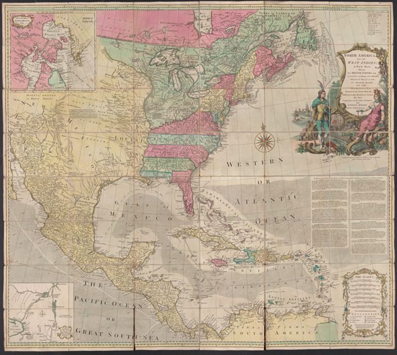
North America, and the West Indies : a new map, wherin the British Empire and its limits, according to the definitive treaty of peace, in 1763, are accurately described, and the dominions possessed by the Spaniards, the French, & other European states : the whole compiled from all the new surveys, and authentic memoirs that have hitherto appeared.
Published / Created:
London : Printed for Carington Bowles, [1764?]
Physical Description:
1 map : hand col., mounted on linen ; 103 x 116., folded to 20 x 14 cm., in case 20 x 14 cm.
Collection:
Rare Books and Manuscripts
Copyright Status:
Public Domain
Related Content:
View a selection of digital images in the Yale Center for British Art's online catalogue
https://collections.britishart.yale.edu/catalog/orbis:584316
Classification:
Maps & Atlas (printed)
Scale:
Scale [ca. 1:5,500,000].
Notes:
In original marbled paper case.
Subject Terms:
Bowles, Carington -- Publisher. | North America -- Maps -- Early works to 1800. | Great Britain -- Colonies -- America -- Maps -- Early works to 1800. | Engraving, Colored -- Specimens -- [1764?].